|
||||||||||


 |
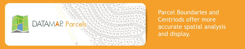
DataMap ParcelsParcel boundaries and centroids provide the most detailed and accurate property location and identification available to organizations that require precision geocoding and accurate property identification in a wide range of industries. Understanding actual parcel boundaries significantly improves the accuracy of any property location data. Industries including financial services, insurance, telecommunications, and government, rely on parcel data to research and analyze property characteristics such as environmental factors, demographics, and tax jurisdictions. DataMap parcels are based on parcel polygons acquired from local governments, internal and third-party sources across the United States providing point-in-polygon analysis and display capabilities. The APN attribute is the parcel identifier that enables users to retrieve additional property information from third party property reporting firms. DataMap parcels assign latitude and longitude coordinates to each of these parcel boundaries. When business decision making requires the highest level of accuracy, DataMap parcel data products provide some of the most detailed geographic analysis available. Unlike simple points used in addressing, parcel boundary data allows property characteristics to be mapped and analyzed across an entire area of interest. Each parcels unique identifier allows it to be linked to other forms of third party information, including valuations, service areas, environmental factors, demographics, and more. Parcel data also enables sophisticated spatial analysis such as proximity, overlay, and buffer zone operations. DataMap parcels enables users to access the highest level of positional accuracy for developing location-based solutions, managing assets, maximizing efficiency, and enhancing business analytics. With DataMap parcels users have access to:
Unlike other solutions that require you to buy additional software or utilize a proprietary interface, DataMap Parcels is platform-independent. The data is delivered in a shapefile to allow you the flexibility to access the parcel data via the platform that you prefer. CoverageDownload Sample Data(* Samples are cuts and do not represent entire County) |